

UPDATE (07/02, 10:16 AM CDT) – Beryl is now a 160 mph Category 5 hurricane, peaking earlier this morning at 165 mph. It is currently forecast to hit Jamaica Wednesday as a C3/4 major hurricane, with the entire island being placed under a hurricane warning.
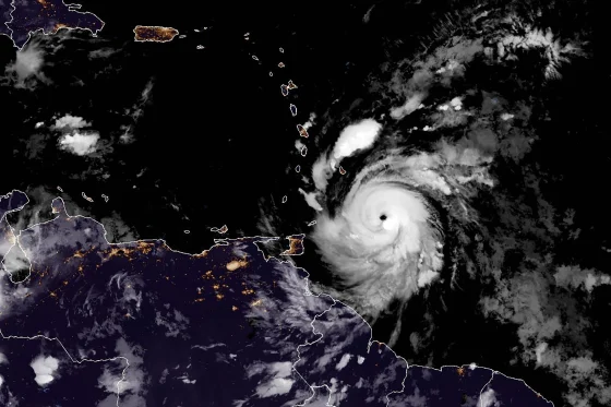
Original article (07/01) – Hurricane Beryl, described by the Associated Press as “dangerous and extremely powerful,” made landfall in the Windward Islands on Monday as a 150 mph category 4 hurricane, just 7 miles shy of category 5 speeds.
Hurricane Beryl, only being designated as such on Saturday, has become the earliest C4 hurricane on record, and the very first of its kind to appear in June. Starting as a tropical depression on June 28th, it quickly intensified to Category 4 strength by the morning of the 30th. After briefly weakening to Category 3 whilst undergoing an eyewall replacement cycle, it regained C4 status, and hit its peak wind speed of 150 miles per hour as it hit the island of Carriacou the next morning.
After making landfall, Beryl continued, and is expected to affect Jamaica Wednesday afternoon, and make a second landfall on the Yucatan Peninsula of Mexico on Friday before entering the Gulf of Mexico as a tropical storm on Saturday, as shown in the below graphic from the U.S. National Hurricane Center.
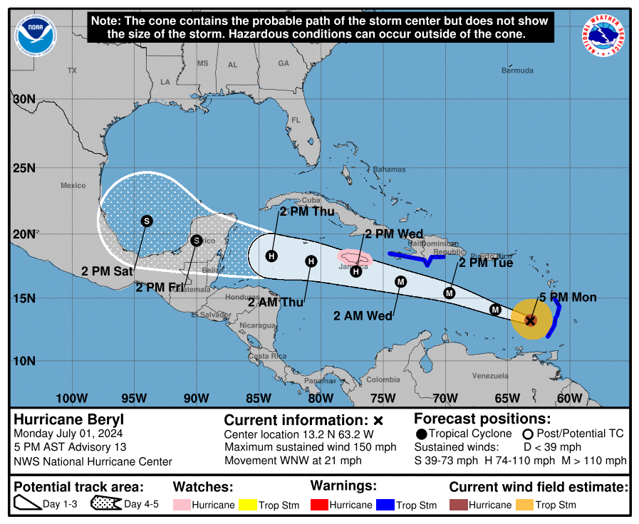
However, some models predict other things. The GFS predicts a landfall in Jamaica and further weakening as it approaches Mexico, while the ECMWF predicts further strengthening and a landfall in Belize. Thankfully, forecasts are not set in stone, but people in these areas should review hurricane preparedness procedures. HBS Weather suggests that viewers consult resources such as Tropical Tidbits and the National Hurricane Center for further updates and forecast information.
Leave a Reply